
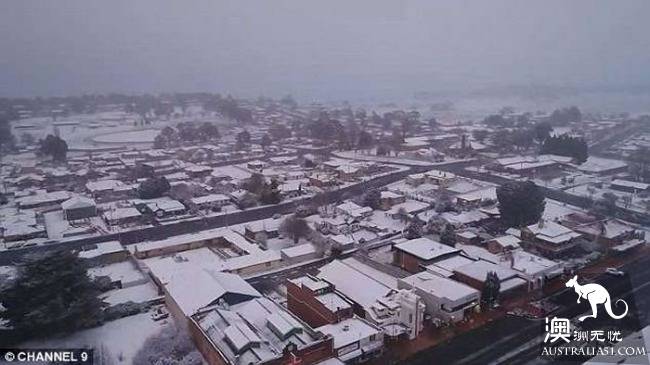
澳大利亚忽如一夜寒流来,新州一些地区气温骤降至零下5度,滑雪场又添了新的降雪。
在周日凌晨,澳大利亚各首府城市均迎来剧烈降温。
据Weatherzone报道,悉尼、阿德莱德和霍巴特气温降至8度,墨尔本和珀斯只有7度,布里斯班9度,堪培拉低至1度。
刺骨的东南风让新州、维州和塔州的居民一沉醒来感到天寒地冻。
Weatherzone的气象学家雅各布.克罗杰(Jacobus Cronje)表示,澳大利亚东南部由于遇到冷锋,气温出现下降。
他说,“东南海岸有一个冷锋,同时还有低压系统。”
冷空气正在东南部地区形成,使得今天变得格外寒冷。虽然新州的大部分地区、首都领地和维州东部现在仍然很冷,但预计气温将逐渐上升。

克罗杰说,在维州西部、南澳东部和新州的远西部,气温将开始回升。同时,他还预测,悉尼和新州东海岸的其他地区将在未来几天内遭遇降雨和大风天气的袭击。
对于那些为滑雪季摩拳擦掌的人来说,寒冷的天可谓是个好消息。
在过去的24小时里,新州雪山的积雪达到60厘米,预计第二天还会有10厘米的降雪。
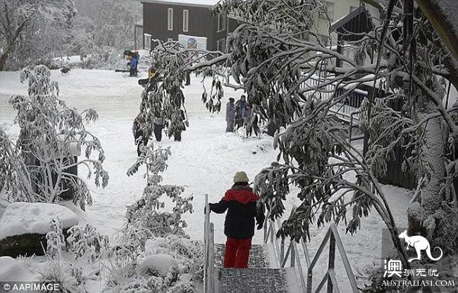
克朗杰表示,周六晚上,Thredbo和Charlotte Pass大约有10-20厘米的降雪。
周六,Thredbo启动了2018年滑雪季,果然是一年中最棒的一天,气温零下5度,积雪达55厘米,预计滑雪场的降雪将持续到周二。
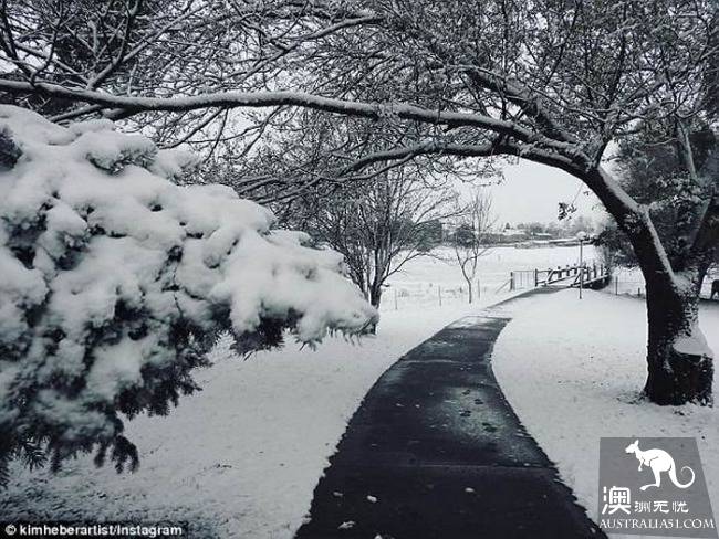
气象局的气象学家Bimal KC表示,首都领地也有可能下雪,尤其是在Brindabella山脉。
KC警告称,新州的猎人海岸(Hunter coast)和Illawarra陡崖将迎60-70km/h的破坏性大风,有时甚至超过90km/h。
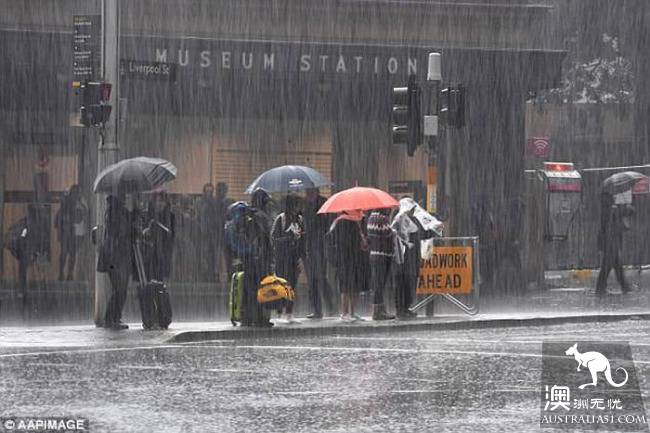
根据气象局的数据,风来自于塔斯曼海的一个复杂的低气压,并将一个西风气流导向新州上空。
据预测,周日晚上,大风天气将沿着海岸向南一直持续到明天。
本文二维码: